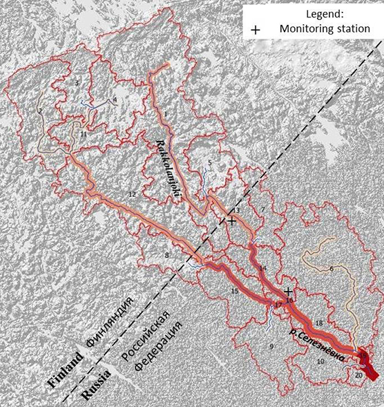
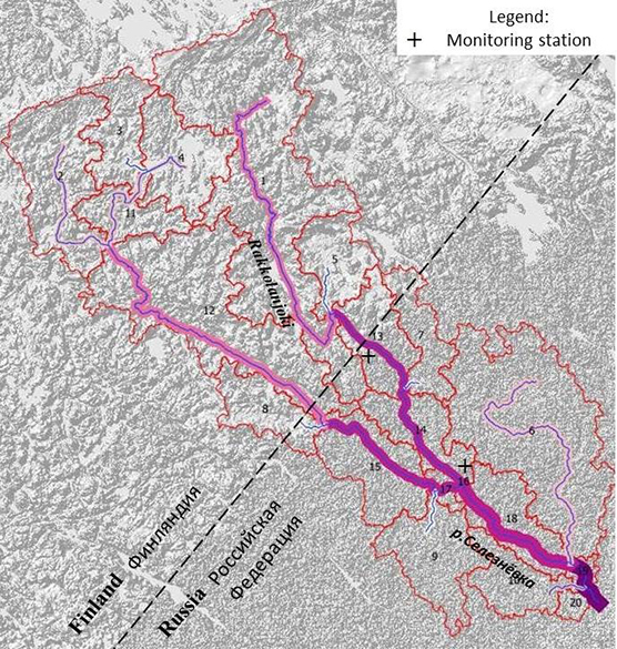
First results of catchment modelling within the framework of SEVIRA project were showed by Dr Alexandra Ershova and Ksenia Korobchenkova (Russian State Hydrometeorological University) during the Fifth All-Russian Scientific Conference of Young Scientists “Complex Research of Young Oceanologists – KIMO 2020”, held on-line on 18-22 May 2020. The presentation “Building a model for nutrient export from the catchment area using GIS technologies for the coastal zone of the Gulf of Finland” showed the first attempts of building a GIS-model based on SWAT (The Soil and Water Assessment Tool) and QGIS (A Free and Open Source Geographic Information System) applications for a transboundary river between Finland and Russia - Rakkolanjoki (Seleznevka). The aim of the study is to use the SWAT model to simulate water protection [TS1] [MK2] activities in the transboundary catchment based on different scenarios (changes of land use or climate changes).
An array of detailed input data was prepared for initiation of the model during the project first year: digital elevation map (DEM file); stream reaches file; detailed land use and soil maps; daily meteorological measurements, etc.
The preliminary results showed that the SWAT model works for the river Rakkolanjoki, however, some values of nutrient load are still overestimated and need further verification and calibration.

Visualization of results of modelling of nutrient load: total nitrogen kg for period 01.01.2011-31.12.2018.

Visualization of results of modelling of nutrient load: total phosphorus kg for period 01.01.2011-31.12.2018.
More in Russian.